Reservation
Online
Book a table online
Book a table online
Being the owner of a Nepalese restaurant, I have, on many occasions, had to use the landmark of Everest (8848m) to highlight where Nepal geographically was. I had never ventured that far up north, and it somewhat irked me. As a boy when I visited Nepal, I would often look out of the window and wonder if the Mountain in the distance was indeed Sagarmatha, the traditional name for Mount Everest. As time passed that view of Everest was obscured by progress. Building upon building connected by masts and towers, I had never felt farther away from the mother of mountains. Little did I know several years later I would be carried off the side of Everest in a helicopter (more on this later).
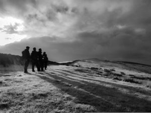
In Stalybridge with friends
In 2015 I started to get into walking, and with a group of friends, we began to explore the vast landscapes that the U.K. had to offer. Living in Manchester gave me a good vantage point to several National Parks within a few hours. With each walk, I kept ruminating about Everest and the possibility of trekking there, so in 2017 we made a plan to attempt to trek to Basecamp (5364m). Bearing in mind that the U.K.’s highest peaks are in the range of 1200m-1345m and The capital of Nepal, Kathmandu, is 1400m it’s quite apt that we start where we left off.
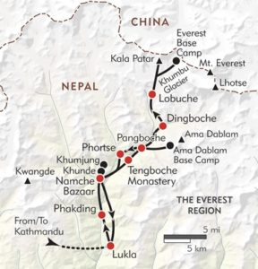
A map of the EBC route
The Everest Basecamp trek spans some 150km and takes 12 or more days to achieve due to acclimatisation. It involves some path walking and scrambling over boulders in sub-zero temperatures. The evenings get cold but the afternoons can be quite warm, so layering is an absolute must as most walks begin at the crack of dawn. The trek starts at 2,860m from the world’s most dangerous runway at Tenzing-Hillary Airport in Lukla and progresses up to 5400m.
We chose to trek in early 2018, but several complications pushed this back, a point to consider when arranging with several people, is time off work. For a 12 day trek, you really should set aside a further week travel buffer as the weather plays a big part in making it to Basecamp and back. There are only really two windows of opportunity when visiting Everest due to the weather, and they are March-April and October-November. Pushing the date gave us plenty of time to prepare and hit the gym, so we set a new time frame of March 2019.
We booked our trek with a tour agency, and we estimated a budget of £2200 including flights to Kathmandu from Manchester. The tour company asked us to set aside a few hundred dollars for the guides and porters, Nepal likes to work in Rupees and Dollars so be prepared to convert everything. A porter is great for the economy of the Solukhumbu District, so allow them to help you carry the load. We set aside 30 dollars for each stop along the way which in hindsight was quite high as most Tea houses offer free accommodation on the purchase of meals. For future reference, a Tea house is a quaint name for a lodge in the Himalayas.
In preparation for our Trek, I started to look at what I was eating and began to regulate my weight. I joined the Waterside gym, and I went 3 to 4 days a week for at least 1hour 30mins each time. My sessions included a mixture of cardio and weights. I also hit the dreaded Stairmaster. Over the coming months, I lost 35kg, and I had never felt fitter. You don’t get to a state like this without some mental willpower, and that takes conditioning. All the time, my eyes were on the prize of Everest Basecamp.
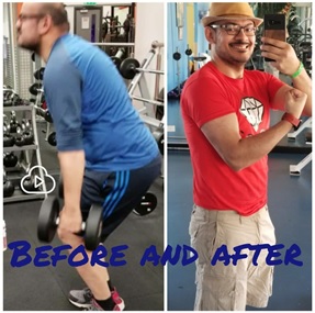
My first session in the Gym and just before my trek
With my fitness in check, I focused on the equipment I would require for the trip. Venturing into the unknown can be quite daunting and packing for every eventuality can be a complicated task. I started with checking the weather forecasts and history for each of the stops over the 12 days. According to the reports, it wouldn’t rain (much), and the temperature would be manageable. So I decided what I would pack. You can see a list of absolute necessary equipment below. N.B. you can only take 12kg approx on the trek due to the KTM to Lukla flight weight restrictions.
● Waterproof Softshell & Down Jacket
● Trousers
● Merino Wool Base Layers & Merino Wool Socks
● Hat with peak and neck sun protection
● Suncream
● A camera or a mobile phone
● 4 Season Sleeping Bag
● Sports Underwear
● Hiking Sticks
● Hiking Boots
● Metal Single Walled Bottle with Neoprene Sleeve
● Hydration Pack With Sawyer Water Filter
● 36Ltr Backpack
● Solar Panels, Powerbank and Chargers with Plug Adaptors
● First Aid Kit
● Travel Insurance with up to 5500m Cover and Helicopter evacuation.
● Diamox (for altitude sickness, readily available in Nepal)
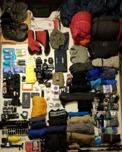
All the equipment I took with me
The flight to Kathmandu was straightforward, so I won’t bore you with the details bare in mind you can collect a visa in the Kathmandu Airport. Once we received our baggage, I visited the NCELL desk outside the airport to obtain a SIM card for around £30, which included 16GB of Data. Most tour operators will collect you from the airport and take you to your hotel. Thankfully you should get a day or so to take in the essential sights of Kathmandu. There are many temples and ancient monuments to visit in and around the Kathmandu Valley, which could be a journey in itself. I recommend staying around Thamel cause it gives you the chance to pick up any last-minute supplies and the nightlife is excellent. Note to self don’t hit the bars the night before a flight to Lukla.
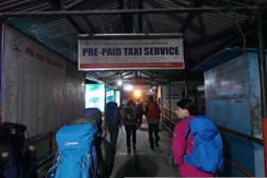
Walkway to domestic airport
We woke at 4 a.m. to prepare for our Lukla flight and the hotel held our suitcases in lockup. When we arrived at the airport, it was very much a waiting game as the weather was abysmal at Lukla. No flights went out and we when back to the hotel at 4 p.m. So this was an opportunity to sample some of the Nepalese Momos.
On the second day, we made it on the plane and to the top of the runway before we had to taxi back, this was groundhog day. Finally, we made the first flight group; a flight group is a set of three planes which leave Kathmandu for Lukla several minutes apart. The first flight took off, but we were held at the taxi point because Lukla had some ice on the runway. They waited for the first plane to land safely before we took off. The takeaway here is to try and get in the second flight of the first group of aircraft to guarantee prompt arrival in Lukla.
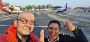
Me and copilot Bipashi who took us out on the successful flight
The flight was quite smooth, and we made it to Lukla in around 30 minutes, but the approach seemed fast. When you see a runway fill the whole of your windscreen as you plummet towards it, you tend to reevaluate things.
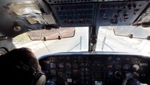
The actual angle of approach into Lukla
Lukla’s runway is at a gradient due to the lay of the land and shortness of the track. The story is flat ground was a premium up here, and the sherpas wouldn’t part with it for Sir Hillary so now you roll down for take-off to build speed and land uphill to slow down fast.
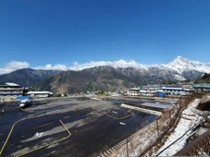
Tenzing-Hillary Airport departure/arrival gates
As soon as you land in Lukla (2860m), you meet your guide & porters then grab a quick bite to eat before starting the trek. We had to separate walking necessities into our day bags, and the rest went with the porter. The 3-hour walk to Manjo (2835m) starts up some icy steps. You immediately feel the thinner air take effect as you adjust your breathing, no altitude training mask prepare you for this.
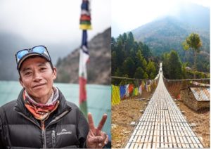
Our guide, Ganesh and the first of many suspension bridges
The walk is almost alpine, and you can’t help but imagine you are in the alps if not for the prayer flags and mantras dotted along the path. We also encountered the first of many suspension bridges, they can be a nerve-racking experience, but you soon get used to it. Once in Manjo, we settled in the Tea house with the knowledge that it all began the next morning again at 5 a.m.
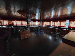
A typical Tea House
Tea houses have a communal living room flanked with benches, tables and dung powered heaters in the middle so generally, they are the warmest part of the Tea house bar the kitchen. It creates a sense of community between travellers when your paths cross on this journey. Another interesting point is that almost all the furniture and cladding is made from wood as its the lightest material they can use and transport up to these villages. The bedrooms are wood-clad boxes with a small window and two beds with thick sheets. Our bedroom in Manjo backed on to the river; it sounded like the M60 at night while you were trying to get some sleep on the cold bed. Next morning any water left in your bottle was frozen, and it was a struggle to leave the warmth of a 4 season sleeping bag with my metal bottle filled with boiling water as a makeshift hot water bottle tucked inside. Showering was out of the question in this climate no matter how smelly we got.
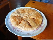
Tibetan Kapsi Bread
For breakfast, we tried the Tibetan bread (think flat doughnuts) with honey and eggs, this would become a recurring theme throughout the trek, but it was the best source of energy. Now we set off for Namche Bazaar (3440m) on a 4-hour trek up some steep terrain and over the world’s tallest suspension bridge, The Hillary-Tenzing suspension bridge.
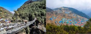
The Hillary-Tenzin suspension bridge and Namche Bazaar from above
I had imagined this trek would be a steady incline, but it was a wave of descents and climbs, and as we approached 3,400m, you felt those climbs. The final accent before Namche was where we caught our first real glimpse of Everest through a break in the hills and it looked majestically special, high on its perch. Then as we banked the final turn, we made it to Namche Bazaar in all its colourful glory. Pictures don’t do it justice as terrace upon terrace of brightly roofed buildings flank the terrain with a network of passageways to provide access. It is a bustling network of travellers and businesses; you really should try the Bakery up there.
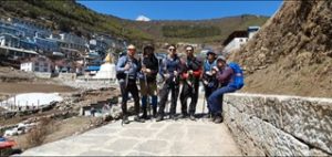
On the Entrance to Namche Bazaar with Everest just peaking over the hills
The next day we went up to Syangboche for acclimation. Syangboche was home to the world’s highest runway (3780m), and now it is the location of the aptly named Everest View Hotel (3880m) where we stopped for refreshments before heading back to Namche. Along the way, we had our first encounter with the Nak, a female Yak. Careful not to disturb them as they are pretty fast and I guarantee you will be out of breath before they are.
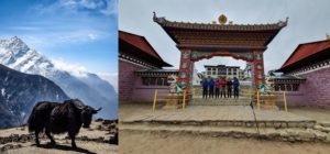
A Nak and Tengboche Monastery Gates
The next day we made our ascent Tengboche (the world’s highest monastery at 3867m) We stopped for refreshments and a brief visit to the monastery which was peaceful with only the hum of the monks heard. We then continued for Pangboche, and at this point, it began to rain, and the path was quite muddy and slippery with slush, thankfully I had my gaiters. We rested for the night in Pangboche.
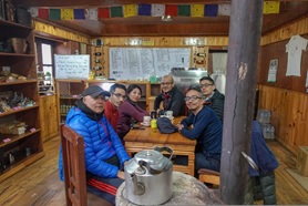
Dingboche Bakery where we had a heated game of Ludo!
We then headed for Dingboche which featured the world’s highest Bakery at 4350m. I am not sure if my tastebuds were hallucinating, but I enjoyed the Apple pie here which was more like an apple cake, and the coffee wasn’t half bad from the owners Frankensteined coffee machine which consisted of two machines side by side with pipes intertwined between them. Having a coffee here allowed you to charge your devices for free otherwise you would have to pay 1500 NRP. For acclimatisation, we decided, against my better judgement to tackle Nangkartsgang Peak (5050m). Even looking at the map, I knew it was going to be complicated with all the contour lines looking like a condensed new order album cover.
We set off for Nangkartsgang at 7:30 a.m. with strong winds and a dusty path in front of us. As we walked further, the path gradually gained gradient until it became a hot pot of boulders and other loose rocks. By this point, I began to get a headache and decided to stop at 5000m while the others carried on. I sat on the side of a mountain I remember how peaceful it was as I gazed upon the Himalayas in front of me. Several minutes later, my guide, Ganesh, returned to inform me that it was only a further 10 minutes walk, so I carried on to the peak. I stood there thinking I had never seen anything like this before, up here scale goes out the window with the vastness of it all.
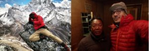
My once in a lifetime pose at Nangkartsgang peak and Me with The owner of our Tea House who is a serial Everest Climber.
On the way down, I had to concentrate, trying not to slide down the steep, dusty rock face while maintaining this pounding headache. Once we returned to the Tea house, I was getting homesick so decided to try and call home, the owner of the Tea house took me to the top room in a corner where the reception worked by resting your mobile on a wooden plank. It was good to speak to everyone back home and gave me the strength I needed to continue the trek. After I made my call, the owner told me about his former time as a sherpa where he had descended Everest and received the next set of guests from Lukla by foot in 24 hours!
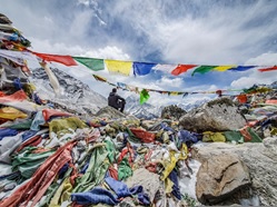
Chukpi Lhara, Everest Memorial
We continued to Tukla Pass (4830m) which was a myriad of steps leading up to the Everest memorial, Chukpi Lhara, where we saw the monument for Scott Fisher. After a brief moment at Chukpi Lhara, we proceeded to Lobuche (4940m) in the snow. Then we carried on to The Pyramid (5050m), which was nestled between to rock faces like a Bond villain hideout. We chose to walk to the Pyramid because they had western amenities due to it being an Italian research facility.
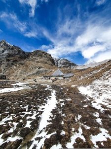
The aptly named Pyramid
Once we settled in, I had a fantastic shower, but I still couldn’t shake this headache which worried me as the next day would be the mega walk to Gorak Shep (5164m) and Everest Basecamp (5365m). That night was the coldest so far, and I slept in my Hiking gear. The next morning we had a tour of the Sensor array at the Pyramid, and the scientist quarters, I still had a mild headache.
We walked from the Pyramid up a sketchy path along a steep edge; there was next to no traction because of ice. We were open to the elements as the winds buffeted us dangerously close to the side. From up there, we could see people on the lower pass, and I asked Ganesh why we weren’t down there, and he proclaimed they are the people who stayed in Lobuche! I would have sacrificed the shower for a safer passage to Gorak Shep. It was so cold up there our hydration pack pipes started to freeze, and this was the first 30 minutes of today’s walk. Once you break 5000m, all that awaits you is rocks and snow, quite a stark contrast from our alpine trek at some 3000m. All the way along, I felt terrible, but we pressed on and made it to Gorak Shep.
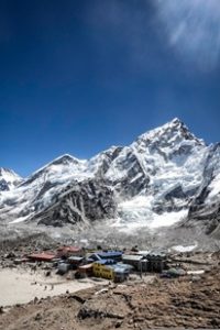
Gorak Shep
We collected our thoughts and rested in the living room while I had a choice to make whether to continue to EBC (5365m) or relax the rest of the day and try and head there tomorrow. Because of the deterioration of my physical state, I decided that if I didn’t go today, I probably would be unable to attempt it tomorrow, so we pressed on. It’s quite something making a judgement call on something which could affect your very existence.
We carried on to EBC, and every step was a struggle to maintain balance. With pressure building up in my head I was using every ounce of willpower and concentration trying not to plummet off the side of a mountain which became increasingly difficult as the boulders and gaps between them got more prominent. All the while, you have to make regular stops to take a sip of water out of your hydration pack, if you have ever tried to have a drink while out of breath you will attest to how hard it is. By this point, every step required a breath.
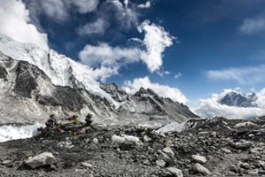
Everest basecamp
After what seemed like hours of scrambling, we made it to EBC, but I felt like I was on autopilot while being present but not present. I wish I got to experience this without the feeling that my end was near, but the thought of having to return to Gorak Shep through the same route filled me with an overwhelming sense of dread.
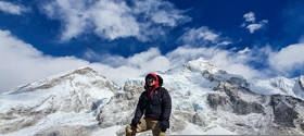
At Everest basecamp
Following the pleasantries and photos, we headed back, and I was concentrating harder than ever before just focusing on each step trying to withdraw myself from the walk back. After several hours I made it back to Gorak Shep, and I sat there in the living room without making a sound still wearing my shades. It must have been like a scene from Weekend at Bernie’s for the others sat around us.
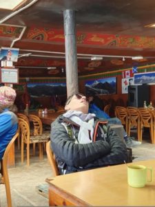
Gorak Shep
My friends tried to work out the best way to get me out of Gorak Shep and father down. We contemplated riding down on the back of a mule, but I didn’t have the balance or energy to endure a ride. By this point, I had lost my appetite and was nauseous. I just lay asleep on the bench as others continued about their business. The only real option was Helicopter out of Gorak Shep; We arranged an evacuation for the following morning after 10 a.m. I decided to go up to the bed and on the way I throw up in the bin I was pretty sure that wasn’t a good sign, but there was no option but to wait for the chopper, so I went to bed.
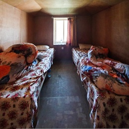
My bedroom in Gorak Shep
Throughout the night, the rest of my group regularly monitored my breathing, the fact I snored made that a much simpler task than finding a mirror. Having a great group of friends with you on the trek will increase your chances of success and the journey will serve to bring you closer together.
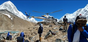
The Gorak Shep Helipad.
The following morning I awoke with the relief that a helicopter was on the way. We had breakfast, and I made my way to the Helipad perched on a hill there was no shelter, and it felt like more of the same trekking. 10 a.m. came and went, and there was no sign of the chopper we stayed on the side of that hill till 1 p.m. with our bags. We headed back down to the Tea house where we rang our tour operator who informed us that the weather was too bad for a chopper to make it to Gorak Shep, so I remained stranded and helpless for another day. I was beginning to resign to my fate and slept for most of that day, only waking to use the toilet.
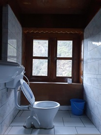
The nicest toilet on the whole trip (Manjo).N.B. toilet bowl is cracked due to cold.
On the subject of Toilets, there was no running water as everything freezes in the pipes, so you have to grab a jug of water from a large bucket to flush the toilet manually the only issue is the water remained frozen on top, so you had to break the ice if you wanted to use the restroom, just remember your toilet roll.
I had hoped that the chopper would have collected me before my head exploded from cerebral oedema, but this was a seemingly unlikely scenario. I forced myself to eat something and went to bed as we were on standby. The following morning I started to feel slightly better, but I wasn’t taking anything for granted. We sat in the living room waiting to hear news from the pilot concerning our ticket off Gorak Shep. Time seemed to slow down as we waited for any news. Finally, at 2 p.m. we were alerted to the news that our chopper would indeed be arriving in the next 30 mins. I darted up the side of that hill, almost like my life depended on it. When the chopper arrived, it felt like a scene from a movie. The force of the Helicopter’s propellers pushed dirt into the air around me. I squinted at the now open door and darted on board with my bag; I was finally on the chopper on the way back to Lukla for a quick refuel. From way up here, I saw all the paths I had walked to get this far. A sense of sadness filled me that I would not get the opportunity to revisit Namche Bazaar and other destinations without the urgency of ascent. We approached Lukla for the second time, but this time we headed for the Helipad.
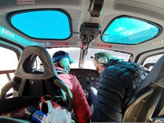
Inside the chopper
Unfortunately, the weather in Kathmandu took a turn for the worse so we could not leave Lukla just yet. The pilot suggested a little place to grab a bite to eat while we waited for the weather to clear. We strolled from the Helipad through a staff building and behind the scenes of the airport, top security here. As we sat waiting, he began to play the guitar, which was laid down beside him; this was the only way to kill time as I was still nursing my headache.
Some hours passed, and my headache had almost dissipated. We found out that the weather had cleared, so we made our way back to the refuelled Helicopter. Once seated, the pilot made his checks, and we took off. As we flew over small villages on the route back to Kathmandu, the weather was choppy. I remember thinking that after all this I was going to meet my end on the return flight. However we land safely in Kathmandu, and there was an ambulance waiting to take me to a climbers hospital. An ambulance was undoubtedly the best way through the traffic of Kathmandu as passers-by peered through the glass.
Once we made it to the hospital, they kept me overnight for checks, After several tests, the doctors say I suffered from altitude sickness, and once I got the all-clear, I spent the extra day, saved from the flight down, exploring Kathmandu and visiting relatives who were relieved I made it to Basecamp and back in one piece.
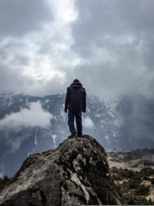
Living on the edge
There were a few things I took from my trip to Everest Basecamp but most of them you couldn’t see. Once you feel like you have reached your limit, you truly discover how much you have in reserve, and that, in my opinion, is an accurate representation of a person. Someone asked me the other day if I would do it all again and upon reflection yes, I would go in a heartbeat! See you in the mountains of the Himalayas.
